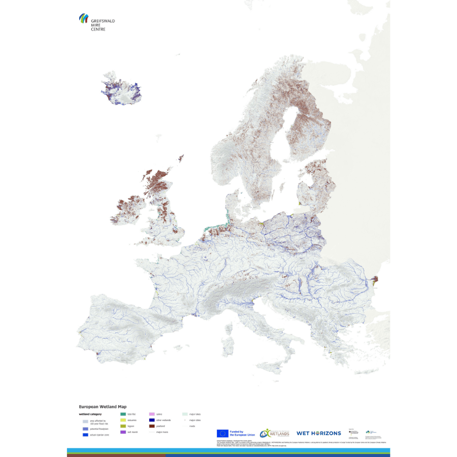
On 2 February, 2025, for World Wetlands Day, the Greifswald Mire Centre, in collaboration with the ALFAwetlands and WET HORIZONS projects, launched the most comprehensive and up-to-date European Wetland Map.
This map compiles data from approximately 200 sources, providing a detailed overview of peatlands, floodplains, and coastal wetlands across Europe. It serves as a key tool for policymakers, land users, and stakeholders, helping to identify flood-prone areas and support informed decision-making.
The map is freely accessible for download and promotes its use in environmental planning and conservation efforts.

